

A beautiful view does not make land investment-ready.
Views, location and an attractive asking price may be what first draw attention to a site. They can be important, but they do not establish whether the land can be legally acquired through the proposed structure, used for the intended purpose, accessed in practice, serviced economically or developed within a realistic budget.
The investment case sits beneath the surface.
Before land is treated as investment-ready, an investor needs to understand its legal foundation, planning context, physical characteristics, infrastructure requirements and commercial pathway. Each of those areas can affect what may realistically be built, how long development could take, how much capital may be required and whether the project retains a credible operating or exit strategy.
The right question is not simply:
Is this land attractive?
It is:
What can realistically be done with it—and at what total cost?
What does “investment-ready” actually mean?
Investment-ready does not mean risk-free, fully approved or immediately buildable.
It means that the material questions affecting an investment have been identified, investigated and incorporated into the decision. Unknowns have either been resolved or clearly allowed for through conditions, contingencies, professional advice and pricing.
For land, this normally requires several forms of review working together:
- Legal: Who owns the land, what right applies and can the proposed transaction and investment structure be implemented?
- Planning: Is the intended use consistent with applicable spatial plans, zoning, controls and approvals?
- Access: Does the land have secure and practical access for construction and future use?
- Infrastructure: Can water, electricity, drainage, wastewater and communications be provided at the required capacity and cost?
- Technical: How do slope, soil, drainage, erosion, boundaries and buildable area affect the design?
- Commercial: Is there a credible development, operating, holding or exit pathway after all costs and risks are considered?
A weakness in one area can change the viability of the entire project.
1. Establish the legal foundation
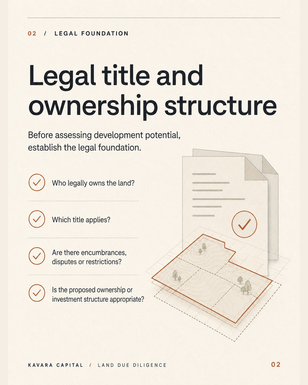
Before assessing development potential, establish what is legally being offered.
Indonesia’s land framework distinguishes between different land rights, management rights and registration arrangements. Government Regulation No. 18 of 2021 forms part of the current national framework governing land rights and land registration. The particular right, holder and proposed transaction must be reviewed for the individual site and investor.
At a practical level, due diligence should establish:
- who is recorded as the lawful holder of the land right;
- whether the seller or contracting party has authority to transact;
- which land right and certificate apply;
- whether certificate details correspond with the physical parcel;
- whether boundaries and area have been independently confirmed;
- whether mortgages, security interests, disputes, claims or other encumbrances are recorded or known;
- whether taxes and relevant land obligations are current; and
- whether the proposed ownership or investment structure is legally appropriate for the investor and intended use.
A photograph of a certificate or an assurance from an intermediary is not a substitute for verification by qualified Indonesian advisers and the relevant authorities.
This review should happen before an investor relies on the land’s development potential. If the legal foundation is uncertain, the view, concept and projected return are secondary.
2. Confirm zoning, spatial conformity and permitted use
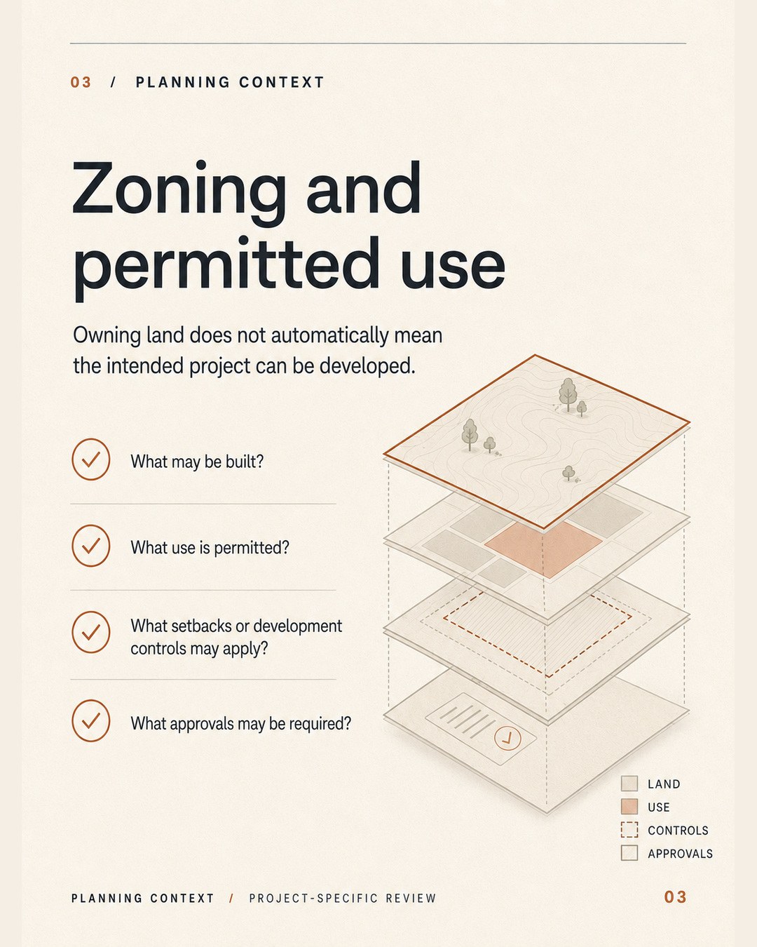
Owning or controlling land does not automatically mean the intended project can be developed.
The location must be assessed against the applicable spatial planning framework. Indonesia’s OSS system identifies Kesesuaian Kegiatan Pemanfaatan Ruang (KKPR)—conformity of spatial utilisation activities—as a basic spatial-planning requirement for business activity. Detailed Spatial Plans, or RDTR, can set out land-use patterns, permitted activities and development controls at local level.
The planning review may need to consider:
- the applicable regional and detailed spatial plans;
- the land-use designation and activities permitted in that location;
- whether the proposed business activity is spatially conforming;
- building intensity, height, coverage and setback controls;
- environmental, coastal, waterway, conservation or hazard constraints;
- access and infrastructure requirements attached to development;
- the approvals required for the intended project; and
- whether current mapping and on-ground boundaries align.
Planning information should be checked for the actual parcel and proposed use. A nearby villa, hotel or commercial property does not by itself prove that the same development is permitted on another site.
The key question is not only, “Is this tourism land?” It is, “What specific activity and development form may be approved on this specific parcel under the current planning framework?”
3. Verify legal and practical road access
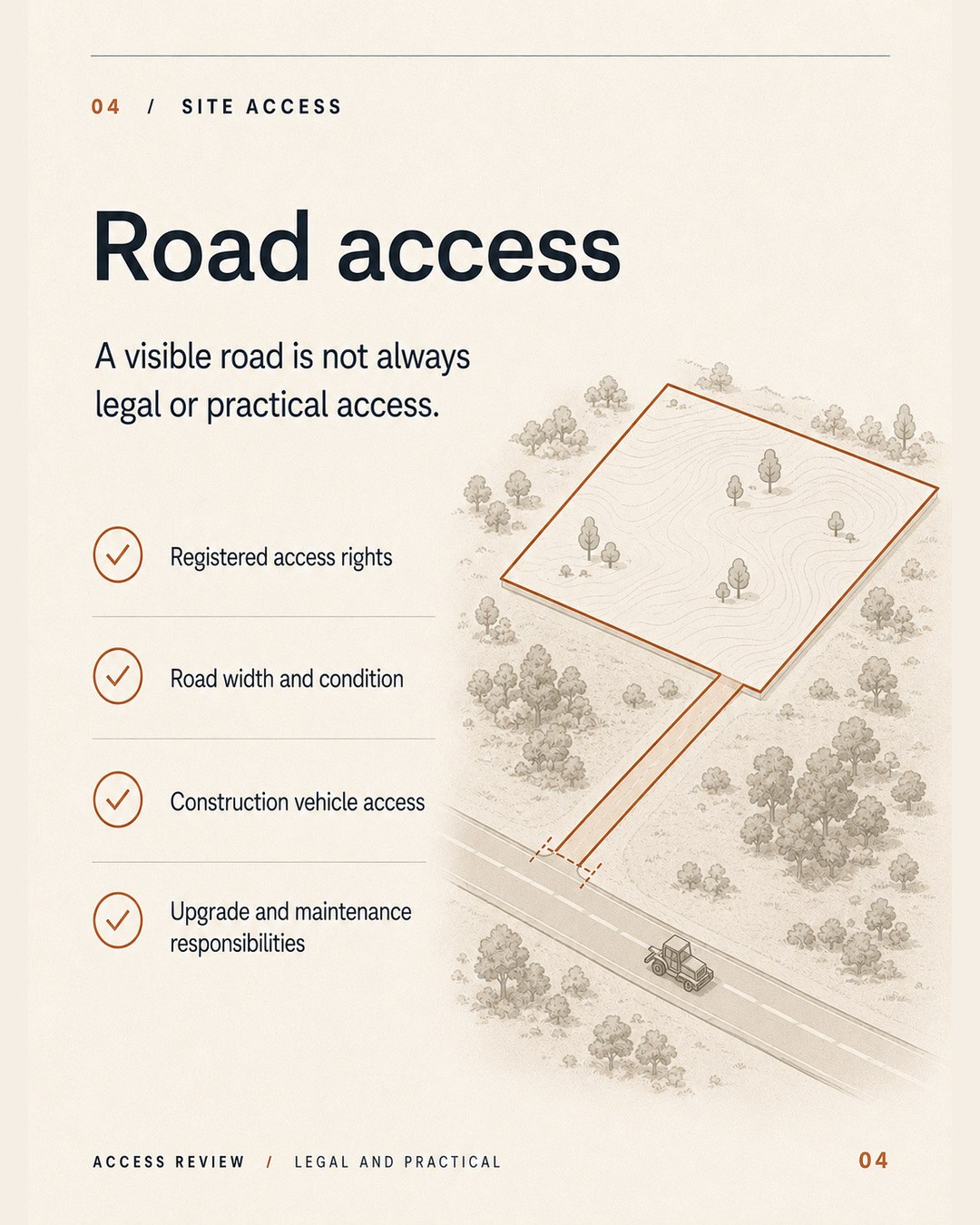
A visible road is not always legal or practical access.
Land may appear connected on a map or during a site visit while still depending on an informal track, a neighbouring owner’s cooperation or an access route too narrow for construction and emergency vehicles.
An access review should consider:
- whether access rights are legally established and documented;
- where the access connects with the public road network;
- the width, gradient, surface and condition of the route;
- whether vehicles can turn, pass and enter the site safely;
- whether construction trucks and equipment can reach the build area;
- whether drainage, bridges, retaining works or road upgrades are required;
- who owns or controls each section of the access route;
- who is responsible for future maintenance; and
- whether access will remain suitable once the project is operating.
Road limitations affect more than convenience. They can influence design, construction methodology, material delivery, emergency access, guest experience, operating costs and eventual resale.
If an access upgrade is required, its land requirements, approvals, neighbour agreements, timing and cost should form part of the investment assessment—not be left as a problem to solve after acquisition.
4. Assess water, electricity and essential infrastructure
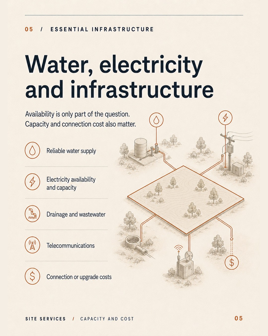
Infrastructure availability is only part of the question. Capacity, reliability, connection method and cost also matter.
The requirements of an undeveloped landholding are very different from those of a villa, a group development or a boutique accommodation project. A nearby power line or water source does not confirm that the required service can be legally, reliably and economically provided.
The infrastructure review should examine:
Water
- the proposed water source;
- legal and environmental requirements affecting that source;
- expected yield, quality and seasonal reliability;
- treatment and storage requirements; and
- demand once the property is fully occupied or operating.
Electricity
- the existing network and available capacity;
- the distance and cost of connection;
- transformer or network-upgrade requirements;
- backup power requirements; and
- projected operating demand.
Drainage and wastewater
- natural water movement across the site;
- stormwater management during heavy rainfall;
- wastewater treatment and disposal requirements;
- soil and topography implications; and
- the effect on neighbours, roads and downstream land.
Telecommunications and operating services
- mobile and internet coverage;
- fibre or fixed-wireless availability;
- waste collection and service access; and
- any infrastructure needed for security, management or remote monitoring.
The full cost may include off-site connections, trenching, storage, treatment, pumps, retaining works, access for maintenance and future capacity upgrades. These costs need to be included before the land price is judged attractive.
5. Understand slope, soil and construction implications
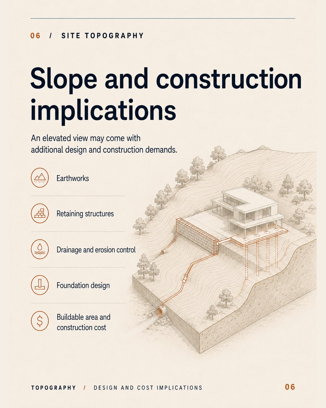
An elevated site can provide a stronger view while creating additional design and construction demands.
Topography influences how much of the advertised land area is practically buildable, how vehicles and people move through the site, how water is managed and what structural solutions may be required.
A proper technical assessment may include:
- a topographical and boundary survey;
- geotechnical investigation;
- slope stability and erosion assessment;
- earthworks and cut-and-fill requirements;
- retaining structures;
- foundation design;
- drainage and stormwater strategy;
- construction access and material handling;
- buildable-area calculations; and
- the relationship between buildings, roads, pools and landscape works.
The steepest or most visually dramatic part of a site may also be the most expensive to stabilise and build upon. Retaining walls, deeper foundations, drainage systems and complex access can materially increase cost before the main building begins.
For investors, the relevant number is not simply the total land area. It is the area that can realistically support the intended development after access, setbacks, contours, drainage, services and planning controls are considered.
6. Calculate the total development basis—not only the land price
Land is often marketed using a price per are or a total purchase price. Neither figure shows the full capital required to create an investable or operating asset.
A realistic development basis may need to include:
- land acquisition and transaction costs;
- legal, tax, corporate and professional advice;
- surveying, planning and technical studies;
- design, engineering and approval costs;
- access acquisition or road upgrades;
- earthworks, retaining and site preparation;
- utility connections and infrastructure;
- building, pool, landscape and external works;
- furniture, fixtures, equipment and operating setup;
- project management and supervision;
- finance and holding costs;
- escalation and foreign-exchange exposure; and
- contingency for unknown conditions and scope changes.
Two parcels offered at the same price per are can produce very different project economics. A more expensive site with verified access, workable topography and nearby infrastructure may have a lower development basis than a cheaper parcel requiring major enabling works.
This is why land should be compared through a development scenario, not only through headline price and area.
7. Define the development, operating and exit pathway
Investment readiness also requires a realistic pathway forward.
Before acquiring land, the investor should understand what role the site is expected to play. Possible strategies might include holding land for future value, developing a single residence or villa, creating a managed accommodation product, participating in a broader development or preparing the site for an eventual sale. Each strategy carries different requirements, timelines, costs and risks.
- 01Develop
- 02Operate
- 03Exit
The investment case should be able to answer:
- What can realistically be developed?
- Who is the intended user, guest, tenant or buyer?
- What evidence supports demand for that product?
- How will the land create or retain value?
- What is the expected development and approval period?
- What capital is required before the asset can generate income or be sold?
- Who will deliver and operate the project?
- What happens if costs rise or the programme is delayed?
- What is the intended operating, holding, sale or exit pathway?
- Is there more than one viable outcome if the preferred strategy changes?
“The area is growing” is not an exit strategy. A credible pathway connects the characteristics of the land with a defined customer, product, delivery plan and commercial outcome.
A practical land-readiness framework
The following framework can help organise an initial assessment. It does not replace professional due diligence.
| Readiness area | Questions that should be answered | Evidence typically required |
|---|---|---|
| Legal foundation | Who holds the land right, what right applies and can the proposed transaction proceed? | Current land documents, authority searches and qualified Indonesian legal review |
| Planning context | What use and development form may be approved? | Current spatial-plan review, parcel mapping and project-specific planning advice |
| Access | Is access legally secured and physically suitable? | Access documents, survey, site inspection and upgrade assessment |
| Infrastructure | Can required services be provided reliably and economically? | Provider checks, capacity assessment, preliminary design and cost estimates |
| Technical feasibility | How do boundaries, slope, soil and drainage affect buildability? | Topographical survey, geotechnical work and preliminary engineering |
| Development economics | What is the total capital basis, including enabling works and contingency? | Concept design, quantity/cost plan and development model |
| Commercial pathway | Who is the customer and how will value be realised? | Market evidence, operating assumptions and documented hold or exit strategy |
The strength of the investment case depends on the quality and consistency of the evidence across all seven areas.
Warning signs that require further investigation
No single warning sign automatically makes land unsuitable. It does mean that the issue should be resolved, priced or protected against before the investor proceeds.
Areas requiring caution can include:
- pressure to commit before core documents are reviewed;
- boundaries that are unclear or do not match the land being shown;
- development claims based only on neighbouring properties;
- access that depends on an informal understanding;
- utilities described as “nearby” without capacity or connection confirmation;
- a steep site marketed without survey, drainage or geotechnical information;
- projected construction costs that exclude retaining, access and infrastructure;
- returns calculated from gross land area rather than realistic buildable area;
- an ownership or investment structure that has not received independent advice; and
- an exit strategy based only on an assumed future increase in land prices.
The appropriate response is not necessarily to reject the site. It is to determine what evidence is missing, who should verify it, what it may cost to resolve and whether the remaining risk is acceptable.
Due diligence should improve the decision—not simply confirm it
Effective due diligence is not a search for reasons to support a purchase already emotionally preferred.
Its purpose is to test the investment case. That may confirm the opportunity, identify conditions that should be satisfied before proceeding, change the proposed development, support a different price or show that the site is not aligned with the investor’s objectives.
A compelling view can still form part of a strong project. The difference is that the value of the view must be considered alongside the legal, planning, access, infrastructure, technical and commercial realities beneath it.
The question beneath the surface
Land becomes investment-ready through evidence—not presentation.
Before moving forward, investors should be able to explain:
- what is legally being acquired or controlled;
- what may realistically be approved and developed;
- how the site will be accessed and serviced;
- how its physical characteristics affect design and cost;
- how much capital is required from acquisition through completion; and
- how the completed investment is expected to operate, hold value or exit.
The right question is not simply, “Is this land attractive?”
It is, “What can realistically be done with it—and at what cost?”
Strengthen your due diligence
Explore Kavara Capital’s Investor Resources for a more structured introduction to Lombok property investment.
You can also access the 10 Questions Every Lombok Investor Should Ask Before Investing or book a private consultation to discuss your objectives and potential investment pathway.
For a specific question, start a conversation with Kavara Capital.
Regulatory reference points
- Government Regulation No. 18 of 2021 — national framework addressing management rights, land rights, apartment units and land registration.
- OSS: Spatial Conformity Requirements — official overview of KKPR as a basic spatial-planning requirement for business activity.
- Ministry of Agrarian Affairs and Spatial Planning: Spatial Planning — official overview of detailed spatial-plan content, including land-use patterns and utilisation controls.
- Government Regulation No. 16 of 2021 — national framework governing building implementation, including building approvals.
Regulations, plans, mapping and approval processes can change and may be supplemented by provincial or local requirements. Every property and proposed project should be reviewed using current information by appropriately qualified Indonesian legal, planning, tax and technical advisers.
This article provides general educational information only. It is not legal, tax, financial, engineering, planning or investment advice and should not be relied upon as confirmation that any land or project is suitable, compliant or investment-ready.